Azure Maps Cluster Spider
Azure Maps Cluster Spider
MODEL-DRIVEN APPSMANAGED SOLUTION AVAILABLE
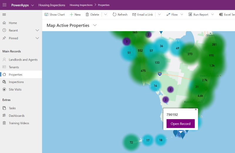
A control to view your data using Azure Maps cluster spider. You can pop open records direct from the map, useful for field workers to see where they have to go for the day, and creates a very cool visualization.
Author: Alan O'Keeffe# azure maps # cluster spider